Call of the Wild. The Nome Serum Run. The Iditarod. Dogs have played a legendary part in Alaska’s history. Because our family loves dogs and we own a mixed breed with some husky in her, a dog sled ride was high on our bucket list. Our visit in March provided the perfect opportunity to experience real Alaska dog sledding. We didn’t know until after we scheduled our trip, that it would also coincide with the start of the Iditarod. So not only were we able to check off the dog sled ride, we also got a chance to watch the quintessential Alaska event known as “The Last Great Race,” all in the same day.
Greeting the Sled DogsGreeting the Sled Dogs
We started off at Snowhook Adventure Guides of Alaska in Willow. After a brief orientation, we were paired up with teams of sled dogs and a guide. Our guide Justin joked with us about “being new here” and “not sure how this is going to go.” Only after the ride did he reveal that he has competed in the Iditarod. The sleds included a seat in front, the guide in the middle, and a place on the back to ride the rails. I rode the rails with my wife on the seat in front.
Sled Dog RideSled Dog RideSled Dog RideSled Dog Ride
From watching videos I had expected a rather gentle ride along peaceful trails. What we experienced was more like a roller coaster through the woods and up and down hills. The dogs were raring to go since this was their first ride of the day. They took off at a speed that made it difficult to hold on to the back of the sled. It reminded me of skiing the way that I had to shift my weight as we went around turns. My wife said even in the seat she found it difficult to hold on at times. A couple of times we met up with other teams on the trails and narrowly missed a collision. It was a thrilling ride that far exceeded our bucket list expectations. If we lived in Alaska I think we would want to get a dozen sled dogs and take up recreational mushing.
Sled Dog Ride
After enjoying a post-ride chili lunch at Snowhook we made our way with thousands of others to the Iditarod restart at Willow Lake. In past years the race started in Anchorage, but due to lack of snowfall many years, it was moved about 70 miles north. Now Anchorage hosts a ceremonial start, but the real race starts in Willow.
Iditarod Restart
A party-atmosphere was already starting on the frozen Willow Lake. Fans staked out places along the fenced-off course, setting up ice-fishing tents, grills, and firepits. Snowmobiles raced around the lake. A girl-scout and her dad dressed up as cookies did a brisk business selling to the crowd. At 2:00 PM, the race began with announcers introducing mushers starting every two minutes. The dogs were so excited the mushers had to apply the brakes on their sled to keep them in check for the long haul ahead. The crowd cheered for their favorites with signs and took cell phone videos. Several mushers gave high fives to the crowd as they passed by. We had been told at Snowhook to cheer for three racers that were friends of theirs and we knew the names of some of the winners from previous years.
Iditarod RestartIditarod RestartIditarod Restart
38 teams started the race to Nome which will take them eight days or more. And then it was all over, with a big-city style traffic jam as everyone returned to their cars at the same time. Because we had seen the start in person we have followed the race ever since, including news of five-time winner Dallas Seavey having to shoot a moose that threatened his dogs on the trail, sending one to back to Anchorage for surgery. Who knew that the Iditarod includes rules for this kind of situation in which the musher has to gut the moose to be picked up later and processed to donate the meat to the native villages along the route? Seavey ended up taking a two-hour penalty for not properly gutting the moose, but one can only imagine the difficulties involved in gutting a 1000+ pound moose with dogs barking and the limited resources he probably carried with him. Only in Alaska.
Only in Alaska applies to most of the items on our bucket list. Maybe some of them may be experienced in other parts of the world, but Alaska stands apart for so many historic and legendary reasons. Visiting Alaska is a once-in-a-lifetime experience and we have had the good fortune to have traveled there four times and counting. Now that we’ve completed our initial bucket list, we’ve discovered other future destinations and activities to add to the list. With a state so large and so full of natural beauty, I’m not sure we could ever really exhaust all the possibilities. But it sure is fun to try. It’s no wonder so many people have been drawn there over the years. It’s a long way from the lower 48 and it’s a hard country to survive in. But like the furs and gold that attracted the first mountain men and sourdoughs, it has rewards unlike anywhere else. As John Muir wrote in his journal, “You should never go to Alaska as a young man, because you’ll never be satisfied with any other place as long as you live.” I think I now know what he meant.
“And God saw everything that he had made, and behold, it was very good.”
Alaska has so many iconic attractions it is almost impossible to visit without making a bucket list. In three previous trips to Alaska we marked the following off our bucket list:
Taking a glacier/whale watching boat tour in Kenai Fjords National Park
Catching a king salmon
Visiting Hatcher Pass/Independence Mine
Climbing The Butte in Palmer and seeing bald eagles
Hiking and seeing a moose at the Eagle River Nature Center
Seeing a mama grizzly with three cubs fishing for salmon at Russian River Falls
Walking the beach on the Homer Spit
Hiking the Savage River alpine trail and seeing the sled dog kennel in Denali National Park
Taking a river tour by jet-boat at Talkeetna
Walking around turquoise-blue Eklutna Lake
Driving the McCarthy road to see the Kennecott Mine town and walking on the Root Glacier in Wrangell-St. Elias National Park
Kayaking to a glacier in Valdez
Besides these, the sights we saw on the Seward, Sterling, Parks, Glennallen, and Richardson Highways deserve honorable mention. Many of these would be bucket list views in any other state, but in Alaska they are commonplace.
Three main Alaska bucket list items remained for us: seeing Denali up close, seeing the Northern Lights, and taking a sled dog ride. We planned the trip based on scheduled time-off from the army for our daughter, hoping that in March we could complete all three. Arriving at dusk, we drove to our rented Talkeetna airbnb in the dark. The next morning this is what we saw:
Denali Sunrise
As we had our morning coffee and breakfast, the whole Alaska range came into view out the windows. The shadows helped define the scale of this magnificent mountain range with Denali dominating even the next two highest peaks, Foraker and Hunter, which are both taller than any mountain in the lower 48. We felt like that view alone made our trip and we could have stayed there all day watching the mountain change with the increasing light.
Alaska RangeAlaska RangeAlaska Range
A snowshoe hike at the frozen Talkeetna Lakes provided another view of the mountain. And a visit to the town of Talkeetna, still another across the frozen Susitna River. Sunset back at the airbnb closed out the day of amazing Denali views.
Talkeetna Lakes Trail
Talkeetna Lakes
Denali from Talkeetna LakesTalkeetna, AlaskaAlaska Range from the Susitna RiverAlaska Range at Sunset
A common maxim is that because of clouds, Denali is only visible 30% of the time and some say the percentage decreases to 10% for seeing the mountain in it’s entirety. I’m not sure where those figures came from, but two years ago we spent three days in Talkeetna and traveled up to the national park without seeing the mountain at all, so anecdotally our experience confirms the percentages. On this trip we were fortunate to see not only Denali, but all of the Alaska range for a full day before the clouds returned the next two days.
Similar factors involving clouds and solar activity affect seeing the Northern Lights. I had downloaded an app that was supposed to alert me to a high probability of seeing the lights. It did not alert me, although I checked it whenever I woke up during the nights we were there. Early Sunday morning I checked and saw via webcam that the lights were active in Fairbanks. Talkeetna is four hours south of Fairbanks but I thought maybe we would also be able to see them. With the naked eye I could just make out some greenish rays on the northern horizon. I’m not an accomplished photographer so my attempts at capturing them with my old iPhone and even a DLSR camera proved futile. However, when I woke my wife up, we were able to capture this shot with her iPhone 15:
Northern Lights from Talkeetna
Most of the time our photos don’t really capture all that the eye can see, to the point that we’ve often been disappointed with the photos we took. Not this time. Two out of the three remaining bucket list items checked off. The next day we would have an opportunity to do the final bucket list item and more.
“And he carried me away in the Spirit to a great, high mountain, and showed me the holy city Jerusalem coming down out of heaven from God, having the glory of God, its radiance like a most rare jewel, like a jasper, clear as crystal.”
Revelation 21:10-11, ESV
“To him who made the great lights, for his steadfast love endures forever.”
In 1975, John Denver produced a TV documentary about Alaska, including filming in McCarthy and Kennecott. He wrote several songs about Alaska, including the one that inspired me to want to see the Wrangell Mountains. The publicity he generated, along with the general 1970’s trend toward environmentalism and natural preservation, probably contributed to the 1980 designation of Wrangell-St. Elias as a National Park and Preserve. McCarthy was incorporated into the park as a private inholding, allowing those who had settled there to continue living the frontier life that first drew them. However, with the improved access of the McCarthy Road, others have joined them, swelling the population from 28 in 2010 to 107 in 2020. Limited access and land availability, along with the harsh winters provide a moderating damper on further population growth but National Park tourism has now left its mark on the town, at least in summer. The tension between wanting to explore the end of the road and get away from it all, alongside the need to protect and preserve wild places was palpable in McCarthy and Kennecott. In many ways it mirrors our experience in Colorado.
The Wrangell Mountains at the End of the Road
The first time I remember hearing John Denver’s music I was eight years old, on a family vacation in 1973, sitting around a campfire in southwestern Colorado, while my dad and a neighbor played guitars. In those days John Denver was all over the radio and TV, singing about the “Colorado rocky mountain high.” My family would take another Colorado vacation from our home in Texas in 1975, and again in 1977, and virtually every year after that. John Denver is at least partially responsible for my lifelong fascination with Colorado, where I met my wife and where we eventually returned to live, only a few miles from where she grew up. Alas, we live in a suburban neighborhood and not the cabin in the mountains that I once dreamed about, but from our bedroom window we can just see the mountains, and we can be on a mountain trail within 30-45 minutes when we have a free Saturday. That is, unless we get caught in traffic with thousands of other residents and tourists who have the same idea.
My Dad on one of our vacations in Colorado
Despite his environmentalist ethic and efforts to preserve nature and animals, John Denver represented a paradox: he was born in New Mexico, not Colorado, but by trading Deutschendorf for Denver as his last name, making Aspen his home, and singing about his “sweet rocky mountain paradise,” he fundamentally changed Colorado. From 1972 to 2021, the state’s population more than doubled, especially along the Front Range and the I-70 mountain corridor. Maybe it would have happened anyway, but many of those moving to Colorado–like me–were seeking an outdoor mountain lifestyle popularized in John Denver’s music. Even as he extolled the virtues of mountain living, his Rocky Mountain High lyrics include the lines:
“Now his life is full of wonder, but his heart still knows some fear,
of a simple thing he cannot understand,
why they try to tear the mountains down to bring in a couple more,
more people, more scars upon the land.”
Since at least the 1970’s, many in Colorado have had a strong anti-growth sentiment similar to that of McCarthy, although certainly not “off the grid.” The antipathy toward growth expressed in Denver’s lyrics led to the state declining to host the 1976 Winter Olympics. Although Colorado is somewhat economically dependent on tourism, many residents bemoan the “flatlanders” on the trails and slopes. The “no vacancy” attitude of residents is reflected in the bumper stickers proclaiming “NATIVE,” modeled after the state green and white mountain license plates. When we moved to Colorado I felt compelled to explain that my wife was born here, as if to give me some kind of native-by-marriage status. Never mind that the only true Colorado natives are from the Apache, Arapaho, Comanche, Pueblo, or Ute tribes, just as the true Alaskans are Aleut, Inupiat, Yuit, Athabascan, or Tlingit.
Mining left its mark on Kennecott and McCarthy in the 20th Century, just as it did in Colorado in the 19th. Tourism and those wanting to live in the mountains have changed Colorado from the state John Denver first came to “in his twenty-seventh year,” and they are changing Alaska, albeit much more slowly. Four national parks were established in Colorado early in the 20th Century; Alaska now has eight. Rocky Mountain National Park is among the top five most-visited parks in the U.S., with a reservation-system in place to enter the park during summer. We’ve been among those making Rocky Mountain one of the most visited and we have now been among the lucky few to drive the McCarthy Road. Wrangell-St. Elias has nowhere near the visitation of Rocky Mountain, or even Glacier Bay or Denali, and probably never will, due to the difficulty in getting there. But our visit to McCarthy and Kennecott was surely different than the one John Denver made in 1975, and it raises the question: what will it be like in 2075? National Park status certainly helps protect and preserve our national treasures, but like John Denver’s music, it can also create awareness and attract people like us who want to see these national treasures.
Another way our experience in McCarthy differed was that we stayed outside the park at the Copper River Princess Wilderness Lodge. The lodge was closed in 2022 due to difficulties in staffing following the pandemic. When we arrived it was fully booked, mostly by cruise-ship passengers on land excursions. Even though we wanted to explore the wild side of Alaska, I have to admit that we enjoyed staying in an upscale hotel at bargain rates rather than the high-priced rustic accommodations in McCarthy. One morning while waiting on our fancy coffee prepared by a barista, we struck up a conversation with one of the cruise-line passengers. In response to our question about her plans for the day, she said, “I don’t know, we’re going somewhere; I just know I have to be ready to get on the bus at 10:00.” The offhand comment struck us as sad, as if anywhere in Alaska is just another somewhere, just another travel box to check off. Our sense when we are there is a sense of awe and appreciation; it’s puzzling when others don’t share that same response.
We’ve been surprised to encounter the same lukewarm response on Colorado’s 14,000 foot mountains, which some approach simply to “bag the summit” and check off on their list; others blare music from their phones, oblivious to the symphony of sounds nature provides; some leave their trash behind and trample on the tundra; and others attempt a challenging climb completely unprepared and under-equipped as if they were going for a walk in the park. More recently, some seem only interested in the other kind of “rocky mountain high” as Colorado has unfortunately been branded. Although Alaska followed Colorado’s lead in legalizing marijuana, it doesn’t seem to have taken hold in the same way.
Aside from the cruise ship industry, Alaska doesn’t lend itself to simply checking travel boxes–it’s much too large with so much to see. Cell phone coverage is spotty at best; I haven’t seen trash on the trails like I have elsewhere; and most people venturing beyond the roads seem to be prepared to do so. In Alaska you can still get away from it all and see something very few people get to see. That’s what has made our visits there so special. Yes, we’ve seen a glacier from a crowded tour boat in Kenai Fjords, but we’ve also been up close to one in a kayak and walked on another one far from any crowds. Our sighting of a mama grizzly and cubs came not on an expensive flight to Katmai National Park, but on a fishing access trail in the Kenai peninsula. Despite our visit to Denali National Park, we still haven’t seen Denali up close–only a hazy view from Anchorage–but we have marveled at countless other mountains seemingly everywhere we looked in Alaska. Our favorite towns have been out-of-the-way places like Homer and Talkeetna and Valdez and McCarthy.
McCarthy and Kennecott were first established because of corporate greed to exploit the resources of the land. When profits declined the corporation looked elsewhere, leaving behind buildings, houses, equipment, and “scars upon the land.” Others moved in to experience an Alaska life off the grid and built a unique community in harmony with the land, but some moved in exploiting the isolation of the land for selfish purposes. It seems to me that many tourists approach iconic destinations in the same way, selfishly exploiting what the land has to offer and leaving it behind for other destinations, sometimes worse for the wear.
So what to do with the tension between seeing the wild places and keeping them wild? I submit that the attitude with which we approach them makes a difference. Are we there to check a box or to see something sublime? Do we understand the significance and value of what we are seeing? Are we bringing a “leave no trace” ethic to the wild places or are we treating them like our own backyards to do with whatever we wish? Are we prepared to encounter the wild places on their own terms, or are we overly-concerned with bringing the comforts of civilization with us? (OK, we appreciate a comfortable hotel and fancy cup of coffee as much as anyone). Are we respecting both nature and people as we visit or are we placing our own selfish desires above both? It’s a fine line, and none of us may walk it perfectly, but other lyrics from Rocky Mountain High still inspire us to try:
“Now he walks in quiet solitude the forests and the streams Seeking grace in every step he takes His sight has turned inside himself to try and understand The serenity of a clear blue mountain lake“
Kennecott Mines National Historic Landmark
The mission of the National Park Service is to preserve “…unimpaired the natural and cultural resources and values of the National Park System for the enjoyment, education, and inspiration of this and future generations.” (nps.gov/aboutus). It seems that this would be a suitable aim for individual travelers as well–to enjoy, be educated, be inspired, and value the natural and cultural resources ourselves, and to help preserve them unimpaired for future generations. As much as we might like to, we can’t go back and undo the exploitations of the past. But we can approach the wild places with a different attitude of appreciation and respect, and pass on those values to the ones who come after us.
“The heavens are the LORD’s heavens, but the earth he has given to the children of man.” — Psalm 115:16
When the Kennecott Mines shut down in 1938, a ghost town was created almost overnight. Some small-scale mining efforts continued here and there, but the boom financed by corporate interests was over. Local residents who remained pilfered building supplies and equipment in subsequent years, accelerating the natural course of deterioration in a hard Alaska climate. The abandoned buildings fostered an eerie sense of wealth and riches slowly being reclaimed by nature. As early as 1953, fly-in tours were offered to see the ghost town and hear its stories from the old-timers.
Kennecott Ghost Town
In McCarthy, while the population dwindled to a few holdouts from the mining days, others arrived looking for a place to homestead away from civilization. For various reasons, they valued the isolation of the community at the end of the decommissioned railroad. The town took on a back-to-the-pioneer-days atmosphere of self-reliance and self-government, since law enforcement was largely non-existent. At its best, McCarthy after 1938, harkens back to a simpler time, before industrialization changed the world, where neighbors looked out for one another and lived in harmony with nature. At its worst, the long winters took their toll on mental health, feuds developed between residents with competing interests, and in some cases, outsiders were attracted to the isolation for nefarious purposes.
We didn’t know all this when we decided to visit Kennecott and McCarthy. We just knew they were unique towns surrounded by Wrangell-St. Elias National Park. Shortly before our trip, a book was recommended to us about a family that had homesteaded in McCarthy rather recently. We bought the book and took it on our trip, but didn’t really get into it, until our flight home. The book, Pilgrim’s Wilderness, by Tom Kizzia, then came alive because we had experienced in person this town at the end of the road.
On the surface, Robert Hale appeared to be a benign hippie from the 1960’s who, after his first wife died of mysterious circumstances, became a fundamentalist Christian. He remarried to a woman named Rose, with whom he had additional children totaling 16. He referred to himself as “Papa Pilgrim,” as in “Pilgrim’s Progress,” and sought to protect his family from worldly influences by moving to various remote places in New Mexico and Alaska, eventually ending up in McCarthy. His folk-and-gospel music playing children appeared to have an winsome innocence and the family added to the local color of McCarthy. Hale gained notoriety through a dispute with the National Park Service and was initially celebrated as an anti-government iconoclast and champion of the homesteading spirit common to McCarthy. But Hale had a dark side that only came light after a suspenseful reckoning with his adult children. There is much more to this R-rated story than can be told here, but suffice it to say that Papa Pilgrim was one of those attracted to the isolation of McCarthy for nefarious purposes.
Author Tom Kizzia had originally researched the history of McCarthy to include in his first book, but decided the Pilgrim story warranted a book of its own. He then wrote Cold Mountain Path, as a history of McCarthy-Kennecott since the closing of the mines. This book also came alive after our visit there and includes many fascinating story lines, but one particular story stands out.
Lou Hastings was another outsider, drawn to McCarthy-Kennecott for the isolation. A computer programmer by trade, Hastings had an interest in conservation and the history of Kennecott. He honeymooned with his wife at the Kennecott Glacier Lodge and two years later bought a former mill-worker’s cabin there. The marriage failed and Hastings subsequently spent most of his time alone and apparently depressed and suicidal, despite the efforts of his neighbors to reach out to him. It was later revealed that he had grandiose ideas about going out in an act of environmental terrorism. Angry about the development of the Alaska Pipeline, Hastings developed a plan to blow-up a pump station in Glennallen. In his psychotic state though, he somehow conflated his hatred of the pipeline with his neighbors homesteading in McCarthy-Kennecott. The environment would be better off without the impact left behind by humans. The arrival of the mail plane on Tuesdays was a sort of community gathering for the twenty-two residents of McCarthy. He would start by eliminating his neighbors and then fly in the mail plane to Glennallen and take out the pump station. Hastings killed six and wounded two, before word got around. He was apprehended on his way out the McCarthy road by Alaska state troopers and sentenced to 634 years in prison.
If these stories serve as a warning that McCarthy is no Eden, immune from the problems of the rest of the world, neither is it a hellish place without hope and redemption. The Pilgrim children have moved on from their abusive upbringing and the oldest has written her own book. The survivors of the mail-day murders stayed in McCarthy and navigated a pragmatic solution to the tension between their desire for isolation and the increased tourism brought by the national park: a pedestrian bridge that limits the number of both cars and visitors, and a private vehicle toll-bridge for local residents. Despite the dark stories, many others have thrived and lived peaceful lives in the isolation of McCarthy. Kizzia quotes McCarthy resident Loy Green: “There is a meaning to things that becomes apparent out here…it was not a negative thing about this place. He [Hastings] brought his evil with him. Evil does not exist outside the mind of man.” Long before McCarthy was established in the search for treasure, a similar point was made about the human heart: “The good person out of the good treasure of his heart produces good, and the evil person out of his evil treasure produces evil, for out of the abundance of the heart the mouth speaks.” (Luke 6:45, ESV).
Ultimately, the town at the end of the road is just another place with good people and bad, blessings and hardships, community and loneliness. Perhaps because McCarthy is less populated and more affected by nature and seasons, the fine lines between these dichotomies are more evident. But the laws of nature and nature’s God still apply, even at the end of the road.
“Where shall I go from your Spirit? Or where shall I flee from your presence? If I ascend to heaven, you are there! If I make my bed in Sheol, you are there! If I take the wings of the morning and dwell in the uttermost parts of the sea, even there your hand shall lead me, and your right hand shall hold me. If I say, “Surely the darkness shall cover me, and the light about me be night,” even the darkness is not dark to you; the night is bright as the day, for darkness is as light with you.” — Psalm 139:7-12, ESV
For a few weeks in 1989, it seemed the eyes of the whole world were on Valdez, Alaska. The Exxon Valdez oil spill was a nightly feature on the news. Pristine shorelines stained with oil. Birds, sea otters, and other animal life coated in oil. Workers in hazmat suits striving in vain to contain the oil, and then to clean it up. These images conveyed much more than words could say about the value of protecting the ecosystems in Alaska.
Beautiful Valdez, Alaska
I didn’t know until our trip there that while Valdez will forever be associated with that disaster and the subsequent cleanup efforts, the oil spill didn’t actually do any harm in Valdez itself. The oil instead tragically drifted out into Prince William Sound. Aside from being the terminus for the pipeline, Valdez remains an idyllic Alaskan harbor town nestled between towering peaks with perpetual snow. In fact, Valdez has attracted outdoor enthusiasts for its fishing, kayaking, mountaineering, backcountry skiing, and ice-climbing. Perhaps because it’s difficult to get to, it remains a bit of a hidden gem, which is exactly what attracted us. After our drive to the end of the road in McCarthy, continuing south to the end of the road in Valdez seemed like a logical follow-up.
Valdez HarborValdez Harbor
The forecast had been for rain, but the weather looked OK, so upon arrival we checked into a kayak trip. One was leaving in a couple of hours, which gave us just enough time to explore the harbor and eat lunch at a local place called the Fat Mermaid. Boarding a van from Anadyr Adventures, we drove a few minutes outside of town to Valdez Glacier Lake.
Valdez Glacier Lake
In Kennecott we had walked on a glacier; here we kayaked to the foot of one. As we paddled past the icebergs, chunks of ice in the water tinkled like wind chimes. The guide said the lake is over 500 feet deep, which makes sense if you know that 90% of icebergs are below the surface.
Valdez Glacier LakeValdez Glacier LakeValdez Glacier LakeValdez Glacier Lake
I didn’t get a good picture of it, but we spotted a black bear ambling across a steep hillside next to the lake. After an hour or two of paddling–we lost track of time–the guide steered us to a rocky shore where we she treated us to hot chocolate. Something about drinking it in a place like that made it seem like the best hot chocolate we’ve ever had.
Valdez Glacier LakeValdez Glacier LakeValdez Glacier Lake
Returning to town we ended up back at the Fat Mermaid for a halibut dinner looking out at the harbor. We only spent a day and night there, but Valdez has so much to offer we wished we could have stayed longer. Our return on the Richardson Highway through Thompson Pass, again felt like a drive through a national park. On our way down the weather had been rainy with limited visibility, but on the way out the clouds lifted enough for a stop at Worthington Glacier and some shots out the car window.
Of course, the drive back down the Glennallen Highway was equally stunning, including an impressive view of the “Lions Head” coming from the east.
Lions Head, Glennallen Highway
Our trip was little more than a long weekend, but we filled it with amazing adventures at the end of the road. Hiking on a glacier and kayaking on a glacier lake were unforgettable experiences and we left thankful that there are still places where you can get off the main roads, away from the crowds, out of cell service, and experience a little bit of the wild in Alaska. We added another 800 miles to our exploration of Alaska and yet there is so much more beyond the roads. In a place like Alaska, maybe it doesn’t really matter where you go, as long as you take it all in, give glory to the Creator, and treasure any time that you get to spend together in the Last Frontier.
Who has measured the waters in the hollow of his hand and marked off the heavens with a span, enclosed the dust of the earth in a measure and weighed the mountains in scales and the hills in a balance? — Isaiah 40:12
At the end of the McCarthy Road is yet another road, accessible only to locals and a privately-run shuttle van. After lunch we caught the shuttle to take us the five miles to the Kennecott Mines National Historic Landmark. The Kennecott Mines operated from 1911 to 1938, extracting $200 million worth of copper ore and employing more than 200 people in the mine and 300 in the town. Declining profits and increasing costs of maintaining the railroad led to the closure of the mines in 1938. Literally overnight, Kennecott and its sister town McCarthy became ghost towns, except for a few hardy souls. Wrangell-St. Elias National Park was established in 1980, and efforts were begun to stabilize and preserve the historic buildings of Kennecott.
Kennecott Mines National Historic Landmark
The Kennecott Mill is the dominant feature, rising 14 stories on the mountain above. The mines are actually several miles above the town and were serviced by aerial trams. In addition to the mining operation buildings, bunkhouses, a recreation hall, post office, dairy barn, power plant, and private homes are scattered around Kennecott. Guided and self-guided tours are available, but we wanted to squeeze in yet another destination. I did take lots of pictures though as we walked through town.
Kennecott, AlaskaKennecott Bunk HousesKennecott Post OfficeKennecott Concentration MillKennecott Power PlantKennecott Ruins
Finally, the true end of the road leads to a trailhead. Steep winding trails lead to the former Bonanza and Jumbo Mines, and a relatively level trail leads to the Root Glacier. This is what we had come all that way to see. In the picture above, you can see what looks like a river of rocks next to the Kennecott ruins. I didn’t know until we read the sign that this is part of the Kennecott Glacier. The ice is under the rocks. A couple of miles of trail though, leads to the Root Glacier which is more what I thought of as a glacier–massive sheets of ice.
Map of McCarthy-Kennecott Area TrailsKennecott Glacier with Chugach Mountains in the Background
After a couple of miles of hiking including a creek crossing on planks and giving space to a territorial porcupine, we reached the access trail to the glacier. Here the trail descended steeply over rock scree. We had read cautions about hiking out on the glacier without proper equipment but like the Edgerton Highway compared to the McCarthy Road, the rock scree was more tenuous than the actual glacier.
Root Glacier Access TrailRoot Glacier
Perhaps because of the tiny rocks embedded in glacier, walking on it proved to be easier than expected. We didn’t even put on our traction devices and were able to climb to the first major hill. Certainly they would have been helpful to go farther, but by just going this far out onto the glacier, this is what we saw:
Root Glacier
A river of ice with wave after wave leading up to the Stairway Icefall. The icefall drops more than a vertical mile to feed the Root Glacier. Hiking at least seven more miles along the trail to the Erie Mine would provide an even closer look, but would have required an overnight camp in bear country. Still, by zooming in, we could get a sense of the power behind that wall of ice.
Stairway IcefallStanding on a River of Ice
Knowing that it is always inexorably moving downhill, it was fascinating to think that the ice on exact spot where we stood would eventually melt into the Kennecott River, to join the Chitina and then the Copper on its way to the Gulf of Alaska. Reluctantly, we headed back down the way we came, caught the shuttle back to McCarthy and enjoyed dinner with Alaskan cider and live music at the Golden Saloon.
Golden SaloonGolden Saloon
We still had at least three hours to drive back down the McCarthy Road and the Edgerton Highway to get back to our hotel. We might have bitten off a bit more than we could chew on this very long day, but what a day! Roads over former railroads and trails beside a glacier and rivers of ice. History and making our own memories. Just another spectacular day in Alaska.
Oh, and when we were almost back to the Richardson Highway, a moose sighting to cap off the day:
Roadside Moose
“Have you entered the storehouses of the snow, or have you seen the storehouses of the hail, which I have reserved for the time of trouble, for the day of battle and war? What is the way to the place where the light is distributed, or where the east wind is scattered upon the earth?” — Job 38:23-24
The National Park Service describes the McCarthy Road as follows: “Although regularly maintained by the State of Alaska, the gravel surface makes for slow travel. It will take about 3 hours each way to drive this road. Other hazards can make it even longer: there are curves with limited visibility, heavy rain can cause ruts and potholes, sharp rocks can cause flat tires, and narrow, one-lane bridges make maneuvering large vehicles difficult.” Other descriptions make it sound downright treacherous. There are no services and cell phone coverage is limited. Most rental agencies don’t allow their cars on it. We had no issues other than an extremely muddy back windshield and thought it was actually better than parts of the Edgerton Highway. We did find this description by the NPS to be spot-on: “Once the gateway to tremendous fortunes, it is now your gateway to spectacular scenery, vast wilderness, and adventure. For those willing to leave the pavement behind, this road provides access to many natural and historic wonders of our largest park.”
McCarthy Road
We listened to the audio tour provided by the Park Service, learning about natural features along the way and the difficulties building and maintaining this railway which became the McCarthy Road. In addition to the new bridge over the Copper River, two other historic bridges captured our attention. The first was the Kuskulana Bridge, built of steel for the railroad in 1910, and still in use today as a single lane bridge for cars.
Kuskulana Bridge
After crossing the bridge we parked on the other side and walked down to the bluff to inspect the engineering that has stood the test of time. With a little gymnastics, a catwalk is accessible underneath the girders. Our daughter ventured out over the rushing water, but I was content to remain over land.
Kuskulana BridgeKuskulana Catwalk
The next bridge was the Gilahina Trestle, built in 1911 and a little worse for the wear. We did NOT cross this one and it was difficult to imagine a train filled with tons of copper ore crossing it. The audio tour said 15% of the railroad crossed wooden trestles like this.
Gilahina TrestleGilahina Trestle
In addition to the bridges and the geologic history, the audio tour also suggested that we keep a sharp eye out for wildlife, but the only animals we saw were trumpeter swans. Other than that the McCarthy Road for us was uneventful, though certainly a scenic drive.
Along the McCarthy Road
The McCarthy Road ends abruptly at another bridge, this one for pedestrians. From the bridge we could see the mile-high Stairway Icefall that feeds the Root Glacier. This was our ultimate destination but first, we looked for a place to eat lunch in McCarthy.
The End of the McCarthy RoadThe Root Glacier Icefall from the McCarthy Bridge
A five minute walk takes you to the town of McCarthy which is like stepping back in time. Historic buildings, old cars, old train cars and parts, dirt streets, and dogs. There are around 100 year-round residents, but it is said that there are more dogs than people in McCarthy. The town is inaccessible in winter, except by bush plane, snow machines, or dogsled. The people who live there clearly relish being at the end of the road, but have adapted to the modest summer tourism business the national park brings. We enjoyed a fantastic lunch at an establishment called The Potato, watched carefully by a few of the town dogs.
The long Alaska day was only half over, but much more adventure awaited us on yet another road.
“By awesome deeds you answer us with righteousness, O God of our salvation, the hope of all the ends of the earth and of the farthest seas; the one who by his strength established the mountains, being girded with might; who stills the roaring of the seas, the roaring of their waves, the tumult of the peoples, so that those who dwell at the ends of the earth are in awe at your signs. You make the going out of the morning and the evening to shout for joy.” — Psalm 65:5-8
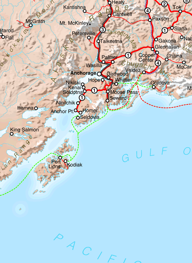
Alaska contains 586,000 square miles of land, two and a half times as much as Texas, and one-fifth the size of the lower 48 states combined. It has approximately 17,000 miles of public roads, which means less than a quarter mile of road per square mile, by far the least of any state (alaska.gov). Most of the roads are located in the south central part of the state and many towns are not connected by roads. Our last trip to Alaska took us as far north as Denali National Park on the Parks Highway and as far south as Homer via the Seward and Sterling highways, but we still drove less than 500 miles of road, north to south. We drove to the end of the road on the Homer Spit and we drove as far as private vehicles are allowed to go on the Denali Park road.
On this trip we headed east on the Glenn Highway, bound for Wrangell-St. Elias National Park. The first 60 miles of the Glenn Highway out of Palmer feels like driving through a national park, with the Chugach Mountains to the south and the Talkeetna Mountains to the north. Every hanging valley seemed to hold a glacier and every turn in the road an even more expansive view. I’m convinced that there are no bad views anywhere you look in Alaska and I took lots of photos out the car window, but couldn’t quite capture the expansiveness and majesty of it all. A panoramic shot at the Matanuska Glacier State Recreation Area came close, but as my Alaska daughter says, sometimes you just have to take it all in.
Matanuska Glacier State Recreation Area
As we continued east a song by John Denver ran through my head: “I can’t wait to see the Wrangell Mountains; I can’t wait to do what I will do….” I had been looking forward to seeing them for months. But like most mountain ranges in Alaska, the Wrangells create their own weather, obscuring our first view as we approached on the Glenn Highway.
Glenn Highway looking east toward the Wrangell Mountains
Fortunately, I had found a deal on a hotel room at the Copper River Princess Wilderness Lodge, operated by the cruise line. Although we were among the few there not on a group tour, it was a very nice place to stay and we woke up the next morning to this view:
Copper River Princess Wilderness LodgeWrangell Mountains from the Copper River Princess Wilderness Lodge
As we headed south on the Richardson Highway, the view got even better at Willow Lake, although the clouds still shrouded the tops of Mt. Drum (12,010 ft.), Mt. Sanford (16,237 ft.), and Mt. Wrangell (14,163 ft.). Wrangell-St. Elias is the largest national park in the United States, covering 13,000 square miles, more than six times as large as Yellowstone. It includes nine of the 16 highest peaks in the United States. There are only two roads going into the park: the Nabesna road and the McCarthy Road, both gravel/dirt. We wanted to go deep into the park to visit the unique towns of McCarthy and Kennecott, and take a hike beyond the end of the road.
The Wrangell Mountains from Willow Lake
From the Richardson Highway we turned east on the Edgerton Highway for 33 miles toward the town of Chitina. The first six miles of the Edgerton Highway point straight toward the Wrangells dominating the horizon, providing a sense of the scale of this land. After that it becomes as crooked as you might expect approaching a mountain range of this size. The McCarthy Road is renowned for its 60 miles of rough road, which the Park Service says to allow three hours to drive, but the Edgerton is no smooth sailing highway with its frost heaves and potholes.
The Edgerton Highway toward Chitina
Along the way, a stop at the Liberty Falls Recreation Area gave us a chance to stretch our legs before embarking on the McCarthy Road.
Liberty Falls
At Chitina, the McCarthy Road begins with a rock cut gateway to another world. The road follows the former railroad bed of the Copper River & Northwestern Railway, financed by the Guggenheims and J.P. Morgan to reach the mine at Kennecott. The railroad was so difficult to build it was nicknamed the “Can’t Run and Never Will” by detractors. As we drove through the rock cut, the best view yet of the Wrangells opened before us as we crossed the Copper River.
Rock Cut at ChitinaCopper River Bridge at ChitinaCopper River Bridge at Chitina
A new highway bridge replaced the old railroad bridge which had to be rebuilt every year when the ice breakup destroyed the wooden pilings. The McCarthy Road was fascinating not only in terms of natural scenery, but also historically, including some relatively recent history. There is much more to show and tell, so I will leave the road itself and what’s at the end of the road for another post.
O LORD, how manifold are thy works! in wisdom hast thou made them all: the earth is full of thy riches. —Psalm 104:24
“Ladies and Gentlemen, we have a passenger needing medical assistance; if there are any passengers on board with medical training, please ring the call button above your seat.” As this announcement on our red-eye flight from Anchorage to Denver vaguely registered in my semi-conscious state I realized that I was the passenger needing medical assistance. After a week of amazing adventures in Alaska the flight home turned out to be more adventurous than we expected.
We had chosen the red-eye flight because it was the only direct flight going back home and it would allow us an extra day on our trip. I had been sleeping for over an hour when I remember sitting up to change positions and leaning my head against the seat in front of me. The next thing I know my wife was asking me if I was OK, telling me I had passed out into the aisle. After using the airsickness bag I then passed out again and my wife rang the flight attendant, prompting the announcement. I passed in and out of consciousness but heard the announcement and became aware of several people standing over me. One was the flight attendant who told my wife, “I’m going to stay right here with you and be your best friend.” Another was a former navy medic and another was a nursing student who also had years of veterinary experience. At least that’s what we found out later. All I knew is that I felt like angels were watching over me.
My medical team was unable to get a pulse but my Fitbit watch read as low as 38 beats per minute. They asked me if I was feeling chest pain (I was not), what I had eaten or drank last, and what medications I take. We were over a remote part of Canada at the time so diverting was not an option. A medical kit was available and they were patched through to a doctor on the ground who recommended oxygen and an IV. The nursing student knew how to administer the oxygen and IV, which stabilized me for the moment, so we continued on to Denver where paramedics would be waiting. We must have received priority to land and taxi to the gate because that is the fastest time to land and arrive at the gate that either my wife or I remember in Denver.
The flight crew requested all other passengers to remain seated so the paramedics could assist me off the plane. We extended a brief word of thanks to my medical team and I was able to walk to the door but then escorted by wheelchair to the gate where I was given a quick EKG and loaded onto a gurney. The paramedic said, “You’re about to see a part of the airport you never see,” and we went down an elevator and outside to a waiting ambulance. Because the EKG was normal and I seemed stable, the ambulance drove without emergency lights to the University of Colorado Hospital, some 16 miles away. Another EKG, another IV, and a blood test, along with an examination resulted in a diagnosis of dehydration and I was released to go home.
Although we were very thankful to have made it home, the dehydration diagnosis didn’t make sense. I had told all the medical personnel that I had a spicy sandwich for dinner the previous night and had drank two solo cups of water with it. I’ve been dehydrated before and in fact, had a history of passing out as a teenager due to dehydration, but I hadn’t passed out in thirty years, and never more than once. My wife had thought I was dying on the plane and my medical team on the plane certainly thought it was serious, so the idea that I just needed to drink more water didn’t add up.
Nevertheless, I rested and drank plenty of fluids that day and felt totally normal the next day. I followed up with my personal doctor later that week and checked out fine. However, due to my lack of confidence in the dehydration diagnosis and my family history, he referred me to a cardiologist, saying, “Let’s see if we can get you some peace of mind.” A few days later, the cardiologist did more EKGs and a stress echocardiogram which was normal. She said that my heart was very healthy, but asked how I felt about wearing a heart monitor for thirty days. Knowing that after what she went through my wife would want me to be absolutely sure I said yes.
The next morning, I received a grave message from the cardiologist that my heart had stopped for several seconds during the night and I needed to see an electrophysiologist right away. An appointment was set up for that afternoon. Another EKG and brief examination resulted in a new diagnosis: sinus arrest and vasovagal syncope. The doctor said because my heart was stopping during sleep and I was sleeping upright on the plane, my brain was not able to get enough oxygen so I passed out. He said if they had been able to lay me down flat I would have been fine, but because I remained in my seat I continued to pass out. The remedy for my condition was a pacemaker, but after answering a number of questions he said it was not particularly urgent and I should go home and talk it over with my wife. I asked if there was a chance my heart would stop and not start again, but he said no, the real danger is that I would pass out again while driving or at the top of the stairs and cause injury to myself and others.
So I went home and discussed it with my wife who was understandably very much in favor of the pacemaker, but I had my doubts. Despite my family history I’ve been a runner for 45 years with a resting heartbeat of 50. Pacemakers are for old people and I still feel young. Even the electrophysiologist called me a “relatively young man.” Surely there was some other contributing factor. Google did not turn out to be my friend as the more information I gathered, the more confused I became. My wife was waking me up at night to make sure I was OK and at her urging I scheduled the pacemaker procedure, but my doubts continued. A few things gave me the confidence to proceed. I found a website pacemakerclub.com and connected with a number of knowledgeable individuals, some who had similar stories of passing out. The original cardiologist I had seen followed up with me and confirmed that the heart pauses were still happening. She said she would keep calling me until I got the pacemaker. I also returned to my personal doctor, who answered all of my questions and confirmed the diagnosis. He knew the electrophysiologist and said he was good. I trust my doctor and felt better about proceeding after talking to him. He also said he would be praying for me.
After the initial health scare on the plane I had asked friends and family to pray that the Lord would reveal what I needed to know about my physical and/or spiritual health. Clearly he answered the first prayer, although once I heard the word pacemaker I felt like saying, “That’s not what I meant!” But if we had not chosen a red-eye flight which caused me to pass out on the plane, and if I had not continued to question the dehydration diagnosis, and if my doctor had not referred me to a cardiologist, and if the cardiologist had not suggested I wear a monitor, then I would not know the condition of my heart. As my doctor said, not only was it going to continue to happen, but it would probably get worse. I believe God’s hand was working in all of these circumstances and needed to trust that He would work through the pacemaker procedure as well.
So on Tuesday, August 16, 2022, I became a member of the pacemaker club. The surgery and recovery were more painful than I expected and a week later I am still getting back to normal. But my wife is sleeping better and we both have more confidence that I will be able to resume traveling and running and hiking and all the other activities that we enjoy together. As for the spiritual lessons, this experience has certainly made me more thankful for the support of family and friends and less likely to take our time together for granted. I am more committed to finding joy in each day and finding ways to serve and communicate love to those around me. And I am more aware of my human limitations and the need to trust in the God who designed my heart with wisdom that the doctors are able to discover and heal through technology. Psalm 73:26 is now my ongoing prayer, “My flesh and my heart may fail, but God is the strength of my heart and my portion forever.” With the Lord every day is an adventure and I thank Him for sustaining me and leading me throughout my journey in this life.
The rain returned for Day 8, so we started the day at the Iditarod Headquarters and Museum. There’s not that much to it–a short video and race memorabilia and a store with pricey branded merchandise, but our dog-loving family enjoyed learning more about this great race and the amazing dog athletes who compete in it.
Iditarod Headquarters and Museum
On our way out of town we stopped at The Butte Burger Place, a local walk-up greasy-spoon type establishment that offers a “Freedom Burger” for $45, including one pound of beef, one pound of bacon, and one pound of cheese. We did NOT order a Freedom Burger but all of us enjoyed the different kinds of burgers we chose, including one with jalapeno poppers on it. God Bless America!
The Butte Burger Place
Our appetites fully whetted, we headed back toward Anchorage and drove south down the Seward highway, thinking we might revisit some overlooks along Turnagain Arm. Stopping at Beluga Point, the wind was so high walking was difficult. We explored a bit and took a few photos, but decided against continuing that direction.
Beluga Point
Instead, our Alaska daughter suggested we at least drive up to the Glen Alps trailhead outside Anchorage for a look around and maybe a hike. From the trailhead we saw a panoramic view of Anchorage and the Cook Inlet, but the dark clouds discouraged a hike.
Anchorage from the Glen Alps Trailhead
So again we improvised and stopped at Alaska Wild Berry Products. Some chocolate-covered berries and other delights were just the thing to follow our indulgent burgers earlier. Hey, don’t judge–we were on vacation!
Alaska Wild Berry Products
Moving on to downtown Anchorage, we did some last minute souvenir shopping. As a native Texan, I noticed this sign near the Anchorage Visitor Center:
Touche’
By this time we were hungry again, so our daughter took us to one of her favorite places, Bread and Brew. They make some unique grilled cheese sandwiches, including one with jalapeno poppers on it. What is it with jalapeno poppers in Alaska? Not quite the Freedom Burger, but very tasty.
Finally, our Alaska daughter dropped us off at the airport for a red-eye flight back home. This would prove to be another adventure, but that’s a story for another time. After driving four hours south of Anchorage and five hours north, we still had not covered even half of the north-south roads of Alaska, much less east-west. It would take over 21 hours to drive from Homer in the south to Prudhoe Bay in the north. By comparison, you can drive across all of Texas in 8-12 hours, depending on the route. We did take some hikes and two very memorable boat rides to where the roads don’t go, but so much of Alaska is inaccessible by road. That alone sets it apart from any other state, including Texas. So that just means we’ll have to keep returning to this great land for more Alaska adventures.


